Information board, Blackwood Methodist Church, Blackwood
Introduction
The photograph on this page of Information board, Blackwood Methodist Church, Blackwood by Jaggery as part of the Geograph project.
The Geograph project started in 2005 with the aim of publishing, organising and preserving representative images for every square kilometre of Great Britain, Ireland and the Isle of Man.

There are currently over 7.5m images from over 14,400 individuals and you can help contribute to the project by visiting https://www.geograph.org.uk
Information board, Blackwood Methodist Church, Blackwood
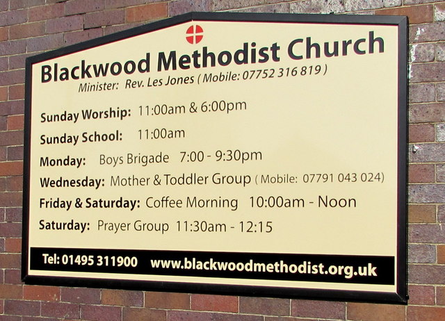
Image: © Jaggery Taken: 15 Aug 2016
The board on the wall here http://www.geograph.org.uk/photo/5074753 shows the religious and secular uses of the church building in August 2016.
Images are licensed for reuse under creativecommons.org/licenses/by-sa/2.0
Image Location
Latitude
51.667654
Longitude
-3.196477