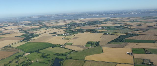
Man-made Landscape
Introduction
The photograph on this page of Man-made Landscape by Bob Harvey as part of the Geograph project.
The Geograph project started in 2005 with the aim of publishing, organising and preserving representative images for every square kilometre of Great Britain, Ireland and the Isle of Man.
There are currently over 7.5m images from over 14,400 individuals and you can help contribute to the project by visiting https://www.geograph.org.uk

Image: © Bob Harvey Taken: 6 Aug 2016
Taken from the early morning flight from Amsterdam to Humberside, there is much to see of North Lincolnshire. Notably, of course, the site and gatehouse of Thornton Abbey, bottom left, but also clearly delineated through the village of East Halton the dead-straight railway line from Ulceby to Goxhill, thence with barely a deviation to New Holland. On the southern bank of the Humber we see the New Holland pier, once the haunt of paddle steamers and now a commercial freight operation run by New Holland Bulk Services Ltd. The city of Kingston-upon-Hull can be seen on the other side of the noble estuary.
Image Location


