Lundy Island from near Exmansworthy
Introduction
The photograph on this page of Lundy Island from near Exmansworthy by Derek Harper as part of the Geograph project.
The Geograph project started in 2005 with the aim of publishing, organising and preserving representative images for every square kilometre of Great Britain, Ireland and the Isle of Man.

There are currently over 7.5m images from over 14,400 individuals and you can help contribute to the project by visiting https://www.geograph.org.uk
Lundy Island from near Exmansworthy
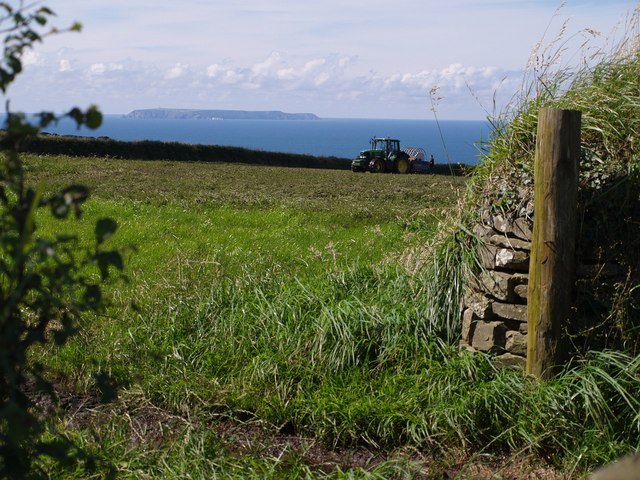
Image: © Derek Harper Taken: 24 Jul 2007
Seen from the path (not on the definitive map) linking the National Trust car park at Exmansworthy with the coast path. The tractor was spreading black slurry. The view may look idyllic but the smell was indescribable.
Images are licensed for reuse under creativecommons.org/licenses/by-sa/2.0
Image Location
Latitude
51.017214
Longitude
-4.466403