The Red Arrows at Hawarden Airport
Introduction
The photograph on this page of The Red Arrows at Hawarden Airport by John S Turner as part of the Geograph project.
The Geograph project started in 2005 with the aim of publishing, organising and preserving representative images for every square kilometre of Great Britain, Ireland and the Isle of Man.

There are currently over 7.5m images from over 14,400 individuals and you can help contribute to the project by visiting https://www.geograph.org.uk
The Red Arrows at Hawarden Airport
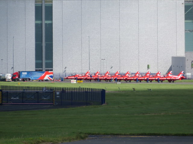
Image: © John S Turner Taken: 6 Aug 2016
The Red Arrows and their support truck as they prepare to leave Hawarden Airport after an overnight stay. The team use Hawarden as a stopover base when they are displaying in the west of the country. Photographed from the Emergency Access Gate on the boundary of the airfield.
Images are licensed for reuse under creativecommons.org/licenses/by-sa/2.0
Image Location
Latitude
53.181017
Longitude
-2.981848