The Master's House, Saltisford [2]
Introduction
The photograph on this page of The Master's House, Saltisford [2] by E Gammie as part of the Geograph project.
The Geograph project started in 2005 with the aim of publishing, organising and preserving representative images for every square kilometre of Great Britain, Ireland and the Isle of Man.

There are currently over 7.5m images from over 14,400 individuals and you can help contribute to the project by visiting https://www.geograph.org.uk
The Master's House, Saltisford [2]
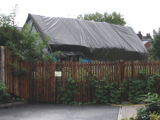
Image: © E Gammie Taken: 26 Jul 2007
Unsure whether this is the front or the back! See Image for view from the other side. Under the plastic is a 15th century building in presumably extremely poor condition - at the time of the photo it was on the English Heritage 'Buildings at Risk' list. A little of the timber frame can be seen on the left. External link to English Heritage listing: https://historicengland.org.uk/listing/the-list/list-entry/1364850
Images are licensed for reuse under creativecommons.org/licenses/by-sa/2.0
Image Location
Latitude
52.286225
Longitude
-1.595345