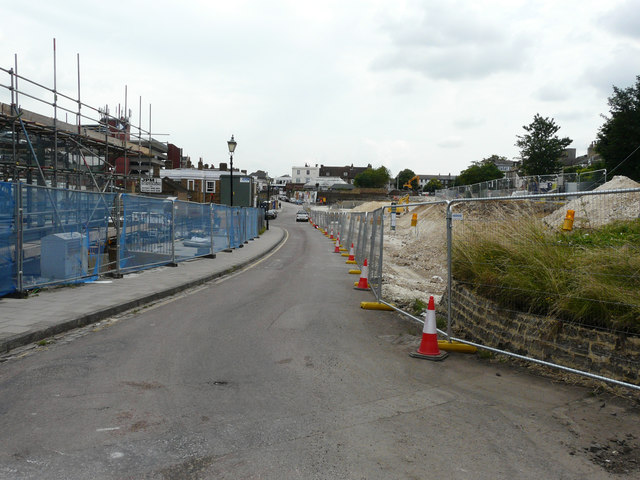
Looking east along Rathmore Road
Introduction
The photograph on this page of Looking east along Rathmore Road by John Baker as part of the Geograph project.
The Geograph project started in 2005 with the aim of publishing, organising and preserving representative images for every square kilometre of Great Britain, Ireland and the Isle of Man.
There are currently over 7.5m images from over 14,400 individuals and you can help contribute to the project by visiting https://www.geograph.org.uk

Image: © John Baker Taken: 21 Jul 2016
On the left, the scaffolding relates to Gravesham Borough Council’s planning application 20151023 which is an “application for listed building consent for the erection of cycle hub building and ancillary cycle shop”. This is at Gravesend Railway Station. On the right, the clearance of the ground relates to Gravesham Borough Council’s planning application 20120441 which is an “application under Regulation 3 for improvements to Rathmore Road including its realignment through the existing car park at the eastern end to a new junction immediately south of 20 Stone Street, widening at the western end involving the demolition of 13 Darnley Road and The Lodge, Rathmore Road and signalization of its junctions with Stone Street and Darnley Road. Improvements to the railway station forecourt, including the provision for taxis and disabled parking (the proposed scheme is part of the Gravesend Transport Quarter Development which was granted outline planning permission in October 2010). KCC granted with conditions 14.11.14”. The location was given as land at and surrounding Rathmore Road, south of the railway, Gravesend, Kent.

