The Border
Introduction
The photograph on this page of The Border by Shane Killen as part of the Geograph project.
The Geograph project started in 2005 with the aim of publishing, organising and preserving representative images for every square kilometre of Great Britain, Ireland and the Isle of Man.

There are currently over 7.5m images from over 14,400 individuals and you can help contribute to the project by visiting https://www.geograph.org.uk
The Border
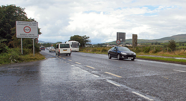
Image: © Shane Killen Taken: 26 Jul 2007
The UK/Eire border not much to look at now, note the change in road surfacing and markings. One of the Official border crossing points during the Troubles it was the site of a heavily fortified army check point. Taking a picture from here during the Troubles would have certainly got you arrested and possibly shot.
Images are licensed for reuse under creativecommons.org/licenses/by-sa/2.0
Image Location
Latitude
55.039252
Longitude
-7.367281