Chapel
Introduction
The photograph on this page of Chapel by David Dixon as part of the Geograph project.
The Geograph project started in 2005 with the aim of publishing, organising and preserving representative images for every square kilometre of Great Britain, Ireland and the Isle of Man.

There are currently over 7.5m images from over 14,400 individuals and you can help contribute to the project by visiting https://www.geograph.org.uk
Chapel
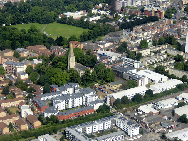
Image: © David Dixon Taken: 6 Jul 2016
The Chapel area of Southampton. St Mary's Church, with its tall spire, is easily visible at the centre of the photograph. The patch of green land near the top of the photograph is Hoglands Park.
Images are licensed for reuse under creativecommons.org/licenses/by-sa/2.0
Image Location
Latitude
50.903297
Longitude
-1.395118