West Howe: footpath U14 reaches Ringwood Road
Introduction
The photograph on this page of West Howe: footpath U14 reaches Ringwood Road by Chris Downer as part of the Geograph project.
The Geograph project started in 2005 with the aim of publishing, organising and preserving representative images for every square kilometre of Great Britain, Ireland and the Isle of Man.

There are currently over 7.5m images from over 14,400 individuals and you can help contribute to the project by visiting https://www.geograph.org.uk
West Howe: footpath U14 reaches Ringwood Road
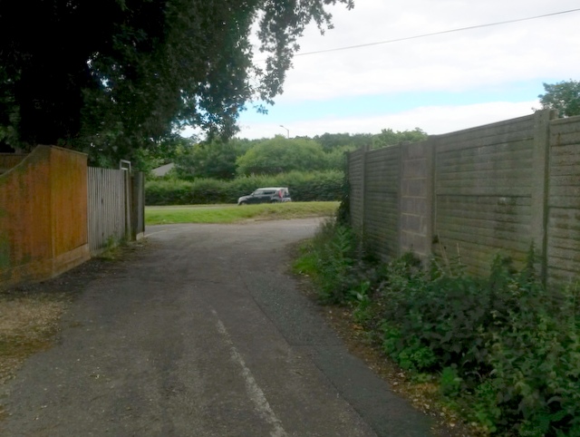
Image: © Chris Downer Taken: 17 Jul 2016
Looking along this public footpath formed by the northern segment of High Howe Lane. It is not navigable by car as a through route but has access to one, possibly two houses from this end, plus a dozen or so from the other. Ahead, we see a black car heading north on the A348 Ringwood Road, while this segment of footpath/driveway heads round to the right on a parallel service road. See Image for the next view up the path from ahead, and Image for the next view behind us, with links to further photos along the route.
Images are licensed for reuse under creativecommons.org/licenses/by-sa/2.0
Image Location
Latitude
50.765184
Longitude
-1.92338