One end of the Pembrokeshire Coast Path National Trail, St Dogmaels
Introduction
The photograph on this page of One end of the Pembrokeshire Coast Path National Trail, St Dogmaels by Robin Drayton as part of the Geograph project.
The Geograph project started in 2005 with the aim of publishing, organising and preserving representative images for every square kilometre of Great Britain, Ireland and the Isle of Man.

There are currently over 7.5m images from over 14,400 individuals and you can help contribute to the project by visiting https://www.geograph.org.uk
One end of the Pembrokeshire Coast Path National Trail, St Dogmaels
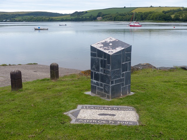
Image: © Robin Drayton Taken: 5 Jul 2016
On the estuary of the River Teifi. The ground sign shows that it is 186 miles to the other end of the path http://www.geograph.org.uk/photo/3988061 . The River Teifi is the longest river which is wholly in Wales and flows 75 miles from its source in the Cambrian mountains to its estuary at Cardigan.
Images are licensed for reuse under creativecommons.org/licenses/by-sa/2.0
Image Location
Latitude
52.089259
Longitude
-4.682343