Strouden: bridleway K35 nears Woodbury Avenue
Introduction
The photograph on this page of Strouden: bridleway K35 nears Woodbury Avenue by Chris Downer as part of the Geograph project.
The Geograph project started in 2005 with the aim of publishing, organising and preserving representative images for every square kilometre of Great Britain, Ireland and the Isle of Man.

There are currently over 7.5m images from over 14,400 individuals and you can help contribute to the project by visiting https://www.geograph.org.uk
Strouden: bridleway K35 nears Woodbury Avenue
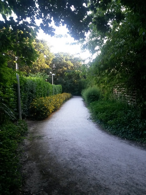
Image: © Chris Downer Taken: 20 Jul 2016
This public bridleway runs around the edge of Castlepoint shopping centre and is the diverted route of the original Valley Road, which today would cut right through the shopping complex. Here, it approaches its southern end, with the end of the shopping centre to the right. This is photo 24 in a series of 28 views along Valley Road, one of the original routes in this rural part of Bournemouth. It is a public right of way, number K35, with a varied character. The northern part, from Throop Road, is a tarmacked and then gravel lane narrowing to a path onto Yeomans Way, classified as a byway open to all traffic. Its hitherto straight course once continued to the top of Woodbury Avenue near Castle Lane, but it was rerouted when the Hampshire Centre shopping complex was built in the mid-1960s and it now skirts round Castlepoint, the Hampshire Centre's successor, on a modern surface and comes out farther along Woodbury Avenue. This latter half is designated as a public bridleway. See Image for the previous photo in the series, and Image for the next.
Images are licensed for reuse under creativecommons.org/licenses/by-sa/2.0
Image Location
Latitude
50.752327
Longitude
-1.837781