Throop: fields alongside Yeomans Road
Introduction
The photograph on this page of Throop: fields alongside Yeomans Road by Chris Downer as part of the Geograph project.
The Geograph project started in 2005 with the aim of publishing, organising and preserving representative images for every square kilometre of Great Britain, Ireland and the Isle of Man.

There are currently over 7.5m images from over 14,400 individuals and you can help contribute to the project by visiting https://www.geograph.org.uk
Throop: fields alongside Yeomans Road
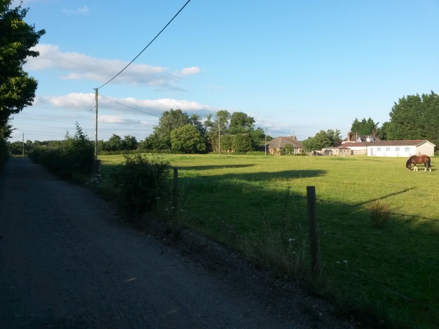
Image: © Chris Downer Taken: 20 Jul 2016
Yeomans Road is one of the original tracks in the Throop area. Today, the southern segment is one of the main roads onto the modern housing estate, but its northern section is still a gravel road. The gravel section forms a public right of way - a byway open to all traffic (or B.O.A.T.) number K21. Here, the road approaches its northern end - the distant bungalow is in Throop Road - and horses graze in a field alongside us. See Image for the next view on the road ahead, and Image for the next view behind us - each with links to further photos along the route.
Images are licensed for reuse under creativecommons.org/licenses/by-sa/2.0
Image Location


Leaflet Map data © OpenStreetMap
Latitude
50.758173
Longitude
-1.838186