Coal plate, St. James's Avenue, Brighton
Introduction
The photograph on this page of Coal plate, St. James's Avenue, Brighton by Robin Webster as part of the Geograph project.
The Geograph project started in 2005 with the aim of publishing, organising and preserving representative images for every square kilometre of Great Britain, Ireland and the Isle of Man.

There are currently over 7.5m images from over 14,400 individuals and you can help contribute to the project by visiting https://www.geograph.org.uk
Coal plate, St. James's Avenue, Brighton
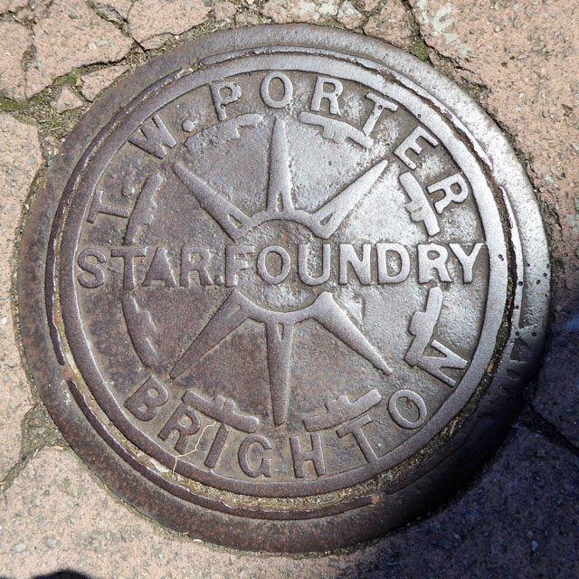
Image: © Robin Webster Taken: 19 Jul 2016
'T. W. Porter Star Foundry Brighton'. The foundry was on Bread Street, with an official address on Church Street. It closed in the 1900s. In 1890 the proprietor was A. Burstow. A plate with his name is shown in Image Whether Porter was in charge before or after Burstow has not yet been determined. I also have a suspicion ironmongers sometimes got the foundry to cast their own names on the plates, otherwise there were an awful lot of foundries about in some fairly small areas.
Images are licensed for reuse under creativecommons.org/licenses/by-sa/2.0
Image Location
Latitude
50.821667
Longitude
-0.130213