Throop: Mill Road (North) goes south
Introduction
The photograph on this page of Throop: Mill Road (North) goes south by Chris Downer as part of the Geograph project.
The Geograph project started in 2005 with the aim of publishing, organising and preserving representative images for every square kilometre of Great Britain, Ireland and the Isle of Man.

There are currently over 7.5m images from over 14,400 individuals and you can help contribute to the project by visiting https://www.geograph.org.uk
Throop: Mill Road (North) goes south
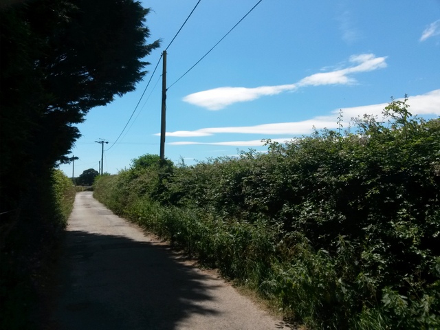
Image: © Chris Downer Taken: 16 Jul 2016
We are looking along Mill Road (North) towards its northern end. It forms byway open to all traffic (or B.O.A.T.) number K22, which used to extend along Mill Road (South) to Castle Lane before the latter segment was incorporated into the modern housing estate as part of the public highway. As can be seen here, it is tarmacked at this northern end but it is not a terribly good surface and is more akin to a track than to a road. See Image for the next view along the road, and Image for the next view behind us.
Images are licensed for reuse under creativecommons.org/licenses/by-sa/2.0
Image Location


Leaflet Map data © OpenStreetMap
Latitude
50.759888
Longitude
-1.842859