Muscliff: the Stour Valley Way and footpath M15 part
Introduction
The photograph on this page of Muscliff: the Stour Valley Way and footpath M15 part by Chris Downer as part of the Geograph project.
The Geograph project started in 2005 with the aim of publishing, organising and preserving representative images for every square kilometre of Great Britain, Ireland and the Isle of Man.

There are currently over 7.5m images from over 14,400 individuals and you can help contribute to the project by visiting https://www.geograph.org.uk
Muscliff: the Stour Valley Way and footpath M15 part
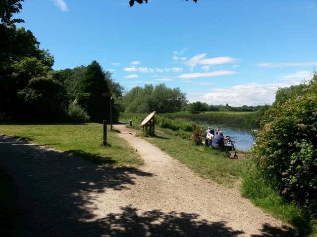
Image: © Chris Downer Taken: 16 Jul 2016
This is one of the few points in the immediate vicinity where the Stour Valley Way runs directly alongside the river. Meanwhile, the route of the public right of way, footpath M15, leaves the route of the Stour Valley Way and heads to the left. This is photo 36 in a series of 43 along the length of public footpath M15, Bournemouth's longest public right of way and the only one over 2km in length. It forms part of the Stour Valley Way long-distance path, although it doesn't see all that much of the Stour. It consists of a tarmacked lane at the Throop end and a good quality gravel path for the majority of its course - it has been improved in the last few years to make it wheelchair accessible and a shared route for cyclists. See Image for the previous photo and Image for the next - these provide links to the other photos all along the route to each end.
Images are licensed for reuse under creativecommons.org/licenses/by-sa/2.0
Image Location
Latitude
50.763962
Longitude
-1.864823