Bodmin Street, Holsworthy
Introduction
The photograph on this page of Bodmin Street, Holsworthy by Derek Harper as part of the Geograph project.
The Geograph project started in 2005 with the aim of publishing, organising and preserving representative images for every square kilometre of Great Britain, Ireland and the Isle of Man.

There are currently over 7.5m images from over 14,400 individuals and you can help contribute to the project by visiting https://www.geograph.org.uk
Bodmin Street, Holsworthy
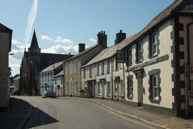
Image: © Derek Harper Taken: 23 Apr 2016
Taken a little further west, and with a slightly clearer view of the two listed buildings: The United Methodist Church and Church Hall https://www.historicengland.org.uk/listing/the-list/list-entry/1104938 and the 4-bay blue house on this side of it https://www.historicengland.org.uk/listing/the-list/list-entry/1104937 . On the right is the Golden Fleece pub.
Images are licensed for reuse under creativecommons.org/licenses/by-sa/2.0
Image Location
Latitude
50.809075
Longitude
-4.354066