Queen?s Park: the subway comes out on the park
Introduction
The photograph on this page of Queen?s Park: the subway comes out on the park by Chris Downer as part of the Geograph project.
The Geograph project started in 2005 with the aim of publishing, organising and preserving representative images for every square kilometre of Great Britain, Ireland and the Isle of Man.

There are currently over 7.5m images from over 14,400 individuals and you can help contribute to the project by visiting https://www.geograph.org.uk
Queen?s Park: the subway comes out on the park
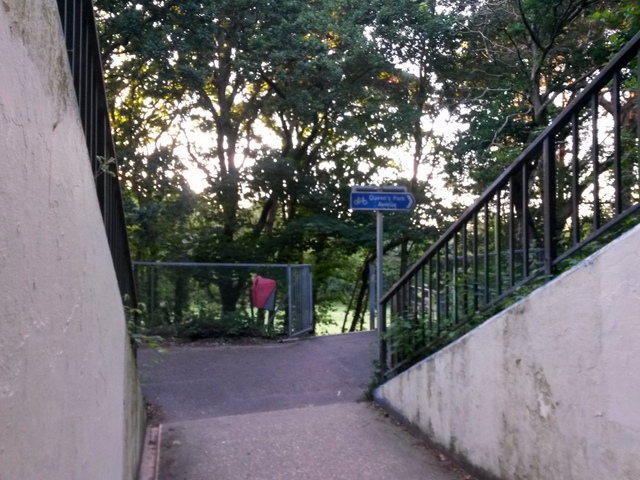
Image: © Chris Downer Taken: 13 Jul 2016
Looking out of the subway, under the main A338 Wessex Way from Littledown Drive, as it emerges onto Queen's Park. As well as linking up with the shared foot/cycle path alongside the Wessex Way, there is access to the park itself straight ahead. The subway also forms public footpath K27, from the approach ramp on the Littledown side to the join between concrete and tarmac just in front of us. See Image for the view into the subway from just ahead, and Image for the next view behind us on footpath K27.
Images are licensed for reuse under creativecommons.org/licenses/by-sa/2.0
Image Location
Latitude
50.741448
Longitude
-1.838952