Water storage tank, Low Westwood Lane, Golcar
Introduction
The photograph on this page of Water storage tank, Low Westwood Lane, Golcar by Humphrey Bolton as part of the Geograph project.
The Geograph project started in 2005 with the aim of publishing, organising and preserving representative images for every square kilometre of Great Britain, Ireland and the Isle of Man.

There are currently over 7.5m images from over 14,400 individuals and you can help contribute to the project by visiting https://www.geograph.org.uk
Water storage tank, Low Westwood Lane, Golcar
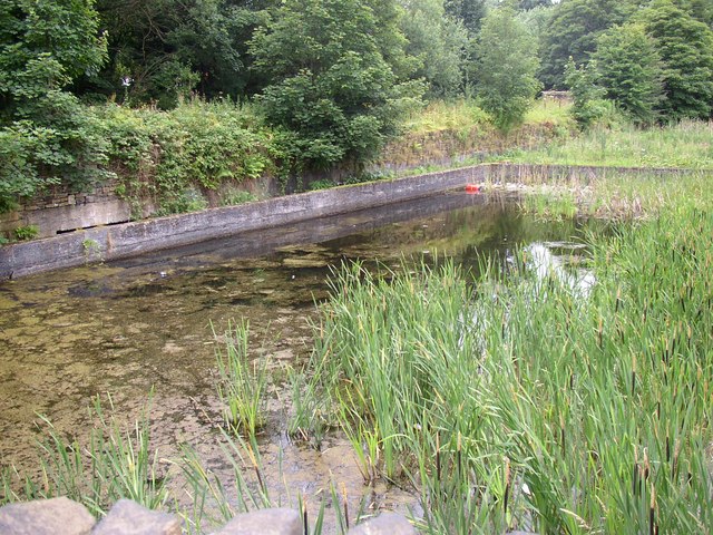
Image: © Humphrey Bolton Taken: 12 Jul 2007
Presumably for Titanic Mills, which are on the other side of the road. There is a gap between the concrete wall and the embankment, and water spilling over the wall would pass through a culvert to the River Colne. The embankment carries a private driveway to Westwood Mills.
Images are licensed for reuse under creativecommons.org/licenses/by-sa/2.0
Image Location
Latitude
53.626946
Longitude
-1.856319