St Mary's Church, Maestir
Introduction
The photograph on this page of St Mary's Church, Maestir by Stephen McKay as part of the Geograph project.
The Geograph project started in 2005 with the aim of publishing, organising and preserving representative images for every square kilometre of Great Britain, Ireland and the Isle of Man.

There are currently over 7.5m images from over 14,400 individuals and you can help contribute to the project by visiting https://www.geograph.org.uk
St Mary's Church, Maestir
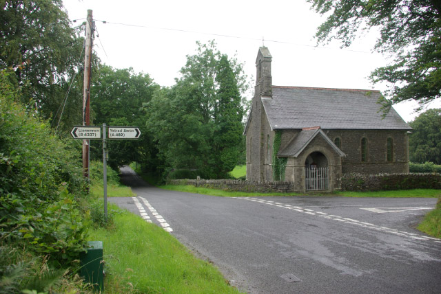
Image: © Stephen McKay Taken: 23 Jul 2007
Maestir, about two miles from Lampeter, consists of little more than this church at a lonely crossroads, and a nearby farm. However, there was once a school here which was provided mainly for children of the Falcondale Estate. Until 1880 lessons were held in the church, but in that year a dedicated building was erected which was used until 1916 when the school closed. The building was then converted into a dwelling, but was dismantled in 1981 and moved to the National Museum of Wales in St Fagans where it is now used to demonstrate traditional village school life to modern children.
Images are licensed for reuse under creativecommons.org/licenses/by-sa/2.0
Image Location
Latitude
52.123397
Longitude
-4.114041