Winton: bridleway N03 heads south from Namu Road
Introduction
The photograph on this page of Winton: bridleway N03 heads south from Namu Road by Chris Downer as part of the Geograph project.
The Geograph project started in 2005 with the aim of publishing, organising and preserving representative images for every square kilometre of Great Britain, Ireland and the Isle of Man.

There are currently over 7.5m images from over 14,400 individuals and you can help contribute to the project by visiting https://www.geograph.org.uk
Winton: bridleway N03 heads south from Namu Road
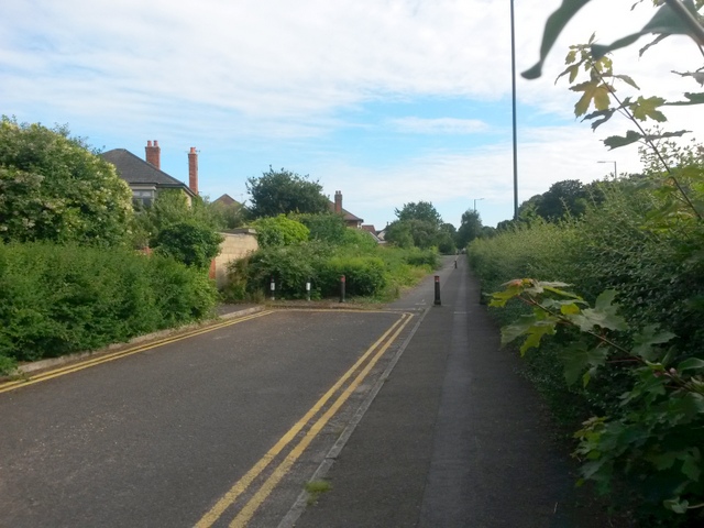
Image: © Chris Downer Taken: 8 Jul 2016
Looking south along this little service road off the end of Namu Road, with a similar one ahead after a gap. This is the historical course of Boundary Road (with the current main version over the hedge to the right) and forms bridleway N03. See Image for more discussion on the routes. Meanwhile, see Image for the next view along the bridleway route ahead, and Image for the next view behind us. Each has links to further pictures along the route.
Images are licensed for reuse under creativecommons.org/licenses/by-sa/2.0
Image Location
Latitude
50.745283
Longitude
-1.888829