Flooded A38 at Severn Stoke
Introduction
The photograph on this page of Flooded A38 at Severn Stoke by Philip Halling as part of the Geograph project.
The Geograph project started in 2005 with the aim of publishing, organising and preserving representative images for every square kilometre of Great Britain, Ireland and the Isle of Man.

There are currently over 7.5m images from over 14,400 individuals and you can help contribute to the project by visiting https://www.geograph.org.uk
Flooded A38 at Severn Stoke
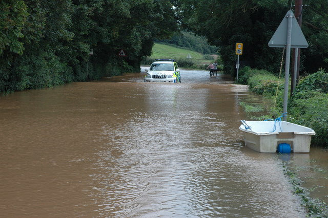
Image: © Philip Halling Taken: 22 Jul 2007
A West Mercia police vehicle negotiates near record flood water on the A38 in Severn Stoke. Flood water very rarely reaches this road.
Images are licensed for reuse under creativecommons.org/licenses/by-sa/2.0
Image Location


Leaflet Map data © OpenStreetMap
Latitude
52.094516
Longitude
-2.209565