Woodside Lodge
Introduction
The photograph on this page of Woodside Lodge by Rose and Trev Clough as part of the Geograph project.
The Geograph project started in 2005 with the aim of publishing, organising and preserving representative images for every square kilometre of Great Britain, Ireland and the Isle of Man.

There are currently over 7.5m images from over 14,400 individuals and you can help contribute to the project by visiting https://www.geograph.org.uk
Woodside Lodge
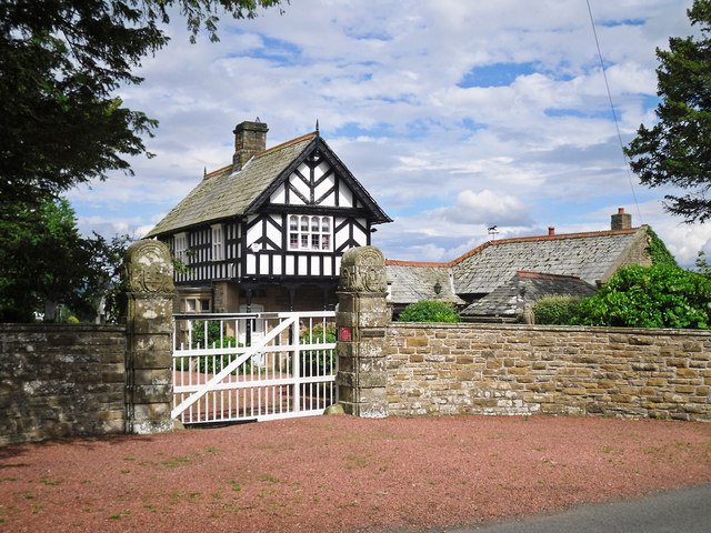
Image: © Rose and Trev Clough Taken: 5 Jul 2016
Built around 1880 as the lodge to Woodside, a large country house. By the 1930s the mansion had fallen into disrepair and most of it was demolished, though one wing survives today as Woodside Park, the house next door (information from parish magazine http://www.stmaryswreay.org/wp-content/uploads/2014/05/Pinecone-4.pdf ). The Woodside estate was owned for many years by the family of Sarah Losh https://en.wikipedia.org/wiki/Sara_Losh , who built St Mary's Church at Wreay http://www.stmaryswreay.org . The lodge is a listed building - for architectural details see Images of England http://www.imagesofengland.org.uk/details/default.aspx?id=77625 . See also Image .
Images are licensed for reuse under creativecommons.org/licenses/by-sa/2.0
Image Location
Latitude
54.845576
Longitude
-2.892128