All Saints' Church, Long Marston
Introduction
The photograph on this page of All Saints' Church, Long Marston by Chris Heaton as part of the Geograph project.
The Geograph project started in 2005 with the aim of publishing, organising and preserving representative images for every square kilometre of Great Britain, Ireland and the Isle of Man.

There are currently over 7.5m images from over 14,400 individuals and you can help contribute to the project by visiting https://www.geograph.org.uk
All Saints' Church, Long Marston
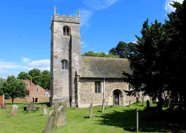
Image: © Chris Heaton Taken: 4 Jul 2016
Parts of the church date from 1180, including the Norman doorway. The tower is 15th century, while significant changes were undertaken during the Victorian period. The building is actually in the village of Hutton Wandesley, but falls within the parish of Long Marston.
Images are licensed for reuse under creativecommons.org/licenses/by-sa/2.0
Image Location
Latitude
53.950663
Longitude
-1.232003