Old Lime Kiln at Low Murrah
Introduction
The photograph on this page of Old Lime Kiln at Low Murrah by Matthew Hatton as part of the Geograph project.
The Geograph project started in 2005 with the aim of publishing, organising and preserving representative images for every square kilometre of Great Britain, Ireland and the Isle of Man.

There are currently over 7.5m images from over 14,400 individuals and you can help contribute to the project by visiting https://www.geograph.org.uk
Old Lime Kiln at Low Murrah
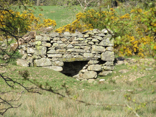
Image: © Matthew Hatton Taken: 18 May 2016
Marked on the 1861 OS Map of Cumberland. A small disused quarry is hidden from view by the gorse bushes.
Images are licensed for reuse under creativecommons.org/licenses/by-sa/2.0
Image Location
Latitude
54.675977
Longitude
-2.975871