Bethania chapel, Rhosybol
Introduction
The photograph on this page of Bethania chapel, Rhosybol by Richard Hoare as part of the Geograph project.
The Geograph project started in 2005 with the aim of publishing, organising and preserving representative images for every square kilometre of Great Britain, Ireland and the Isle of Man.

There are currently over 7.5m images from over 14,400 individuals and you can help contribute to the project by visiting https://www.geograph.org.uk
Bethania chapel, Rhosybol
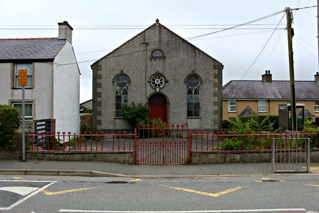
Image: © Richard Hoare Taken: 4 Jul 2016
The Bethania Independent cause began in 1883 and the chapel was completed in the following year, but has long since closed. Fellow Geographer, Eric Jones, featured it in 2009 Image] when apparently an application was to be made to convert into a dwelling.
Images are licensed for reuse under creativecommons.org/licenses/by-sa/2.0
Image Location
Latitude
53.373233
Longitude
-4.364574