Kirby Street, Mexborough
Introduction
The photograph on this page of Kirby Street, Mexborough by David Wilkinson as part of the Geograph project.
The Geograph project started in 2005 with the aim of publishing, organising and preserving representative images for every square kilometre of Great Britain, Ireland and the Isle of Man.

There are currently over 7.5m images from over 14,400 individuals and you can help contribute to the project by visiting https://www.geograph.org.uk
Kirby Street, Mexborough
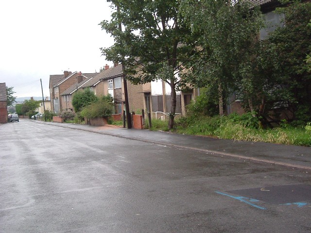
Image: © David Wilkinson Taken: 13 Jul 2007
As part of a programme of housing improvement to deal with long-standing social problems in the area, the Office of the Deputy Prime Minister chose to fund the demolition and rebuilding of Kirby Street. By July 2007, most inhabitants had moved out and certain building materials had been crudely removed by persons unknown, leaving the scene shown here.
Images are licensed for reuse under creativecommons.org/licenses/by-sa/2.0
Image Location
Latitude
53.497384
Longitude
-1.290414