Old railway bridge at Crudgington
Introduction
The photograph on this page of Old railway bridge at Crudgington by John Winder as part of the Geograph project.
The Geograph project started in 2005 with the aim of publishing, organising and preserving representative images for every square kilometre of Great Britain, Ireland and the Isle of Man.

There are currently over 7.5m images from over 14,400 individuals and you can help contribute to the project by visiting https://www.geograph.org.uk
Old railway bridge at Crudgington
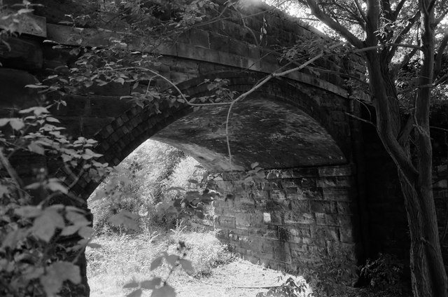
Image: © John Winder Taken: 27 Sep 2015
Crudgington once had a railway station, on the Wellington & Drayton Railway which was opened in 1867 and operated under the auspices of the Great Western Railway. Traffic was never heavy, although the line was used for diversionary traffic right up until closure, especially during electrification work on the London - Crewe line. The establishment of a number of RAF bases in the area during WWII gave a boost to traffic levels and a good deal of freight traffic also used the line, but all to no avail as passenger traffic ceased in 1963, followed by freight in 1967. The track was lifted during 1970. The station master's house and this bridge are all that survive at Crudgington, along with some overgrown steps to where the platform once was and some bits of fencing.
Images are licensed for reuse under creativecommons.org/licenses/by-sa/2.0
Image Location
Latitude
52.758499
Longitude
-2.552369