Sugarhouse Entry, Belfast
Introduction
The photograph on this page of Sugarhouse Entry, Belfast by Albert Bridge as part of the Geograph project.
The Geograph project started in 2005 with the aim of publishing, organising and preserving representative images for every square kilometre of Great Britain, Ireland and the Isle of Man.

There are currently over 7.5m images from over 14,400 individuals and you can help contribute to the project by visiting https://www.geograph.org.uk
Sugarhouse Entry, Belfast
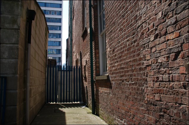
Image: © Albert Bridge Taken: 22 Jul 2007
See Image Sugarhouse (also “Sugar House”) Entry takes its name from the sugar house established there in 1704. The entry later became better known for the “Dr Franklin Tavern” – home to “The Muddlers’ Club”. The entry was closed (using emergency legislation) as a precaution against bombs and is no longer a public thoroughfare. The view is from Waring Street to High Street. See also Image (February 2014).
Images are licensed for reuse under creativecommons.org/licenses/by-sa/2.0
Image Location
Latitude
54.60077
Longitude
-5.926803