The Cube
Introduction
The photograph on this page of The Cube by Keith Edkins as part of the Geograph project.
The Geograph project started in 2005 with the aim of publishing, organising and preserving representative images for every square kilometre of Great Britain, Ireland and the Isle of Man.

There are currently over 7.5m images from over 14,400 individuals and you can help contribute to the project by visiting https://www.geograph.org.uk
The Cube
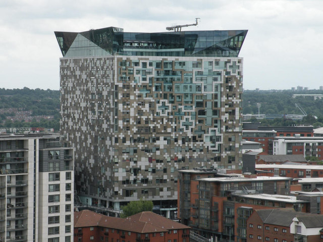
Image: © Keith Edkins Taken: 30 Jun 2016
Multi-functional block claimed to be 25 stories tall, although it's difficult to count. View from 7th floor of the Library of Birmingham.
Images are licensed for reuse under creativecommons.org/licenses/by-sa/2.0
Image Location
Latitude
52.474955
Longitude
-1.907205