Lugton from the air
Introduction
The photograph on this page of Lugton from the air by Thomas Nugent as part of the Geograph project.
The Geograph project started in 2005 with the aim of publishing, organising and preserving representative images for every square kilometre of Great Britain, Ireland and the Isle of Man.

There are currently over 7.5m images from over 14,400 individuals and you can help contribute to the project by visiting https://www.geograph.org.uk
Lugton from the air
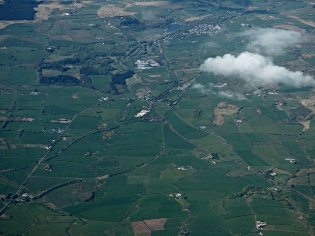
Image: © Thomas Nugent Taken: 15 May 2016
Lugton, in the centre of the photo, was once served by two railway stations on different lines. Lugton railway station was on the Glasgow, Barrhead and Kilmarnock Joint Railway line. It opened in 1871 and closed to passengers in 1966. The Lanarkshire and Ayrshire Railway's short lived Lugton station opened in 1903 and closed 4 July 1932. That line ran to Ardrossan from Glasgow. The present day Glasgow to Kilmarnock line can be seen running from the loch in the distance down to the lower right corner. The disused lines to Beith and Glengarnock can be seen in the lower left corner. The disused line to Neilston can to the left tip of the big cloud.
Images are licensed for reuse under creativecommons.org/licenses/by-sa/2.0
Image Location
Latitude
55.721051
Longitude
-4.549544