Kinson: 3 Anstey Close and footpath E21
Introduction
The photograph on this page of Kinson: 3 Anstey Close and footpath E21 by Chris Downer as part of the Geograph project.
The Geograph project started in 2005 with the aim of publishing, organising and preserving representative images for every square kilometre of Great Britain, Ireland and the Isle of Man.

There are currently over 7.5m images from over 14,400 individuals and you can help contribute to the project by visiting https://www.geograph.org.uk
Kinson: 3 Anstey Close and footpath E21
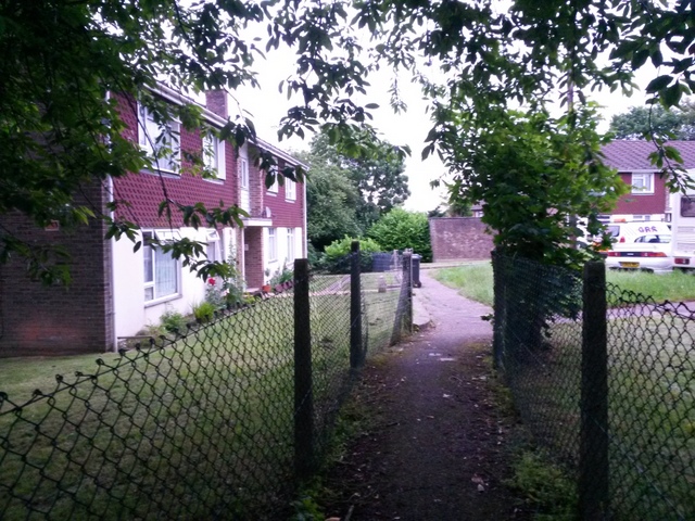
Image: © Chris Downer Taken: 30 Jun 2016
Looking along the public footpath from Wimborne Road (ahead) to Baker Road (behind) as it passes the dead end of Anstey Close. The close comprises four blocks of flats, 1 and 2 to our right, 3 pictured here, and 4 partially in shot in the background. See Image for a view towards us from just past the end of the fences, and Image] for a view into Anstey Close from the path as it passes the bushes far left.
Images are licensed for reuse under creativecommons.org/licenses/by-sa/2.0
Image Location


Leaflet Map data © OpenStreetMap
Latitude
50.768325
Longitude
-1.914157