Market Hall demolition, Warrington Academy Way
Introduction
The photograph on this page of Market Hall demolition, Warrington Academy Way by Matt Harrop as part of the Geograph project.
The Geograph project started in 2005 with the aim of publishing, organising and preserving representative images for every square kilometre of Great Britain, Ireland and the Isle of Man.

There are currently over 7.5m images from over 14,400 individuals and you can help contribute to the project by visiting https://www.geograph.org.uk
Market Hall demolition, Warrington Academy Way
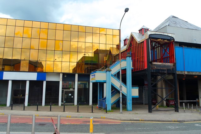
Image: © Matt Harrop Taken: 30 Jun 2016
The bridge from the Academy Way car park to the Market Hall has been removed and the process to demolish the car park that was joined by it to the Market Hall has begun. The demolition of the Market Hall will commence once the temporary home for it has been completed.
Images are licensed for reuse under creativecommons.org/licenses/by-sa/2.0
Image Location
Latitude
53.387642
Longitude
-2.591757