Westbourne: skew-whiff steps on footpath A10
Introduction
The photograph on this page of Westbourne: skew-whiff steps on footpath A10 by Chris Downer as part of the Geograph project.
The Geograph project started in 2005 with the aim of publishing, organising and preserving representative images for every square kilometre of Great Britain, Ireland and the Isle of Man.

There are currently over 7.5m images from over 14,400 individuals and you can help contribute to the project by visiting https://www.geograph.org.uk
Westbourne: skew-whiff steps on footpath A10
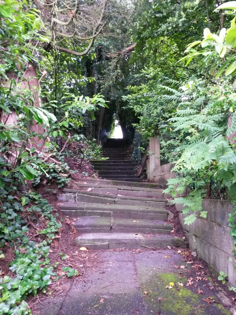
Image: © Chris Downer Taken: 29 Jun 2016
Looking up this steep public footpath towards the Snowdon Road end. The tree on the left has caused the surface to lift somewhat here, ruining the geometric appearance of the path. See Image] for the view behind us and Image for a view from the top end of the path.
Images are licensed for reuse under creativecommons.org/licenses/by-sa/2.0
Image Location
Latitude
50.724519
Longitude
-1.899503