Bear Cross: footpath E05 to Anchor Close
Introduction
The photograph on this page of Bear Cross: footpath E05 to Anchor Close by Chris Downer as part of the Geograph project.
The Geograph project started in 2005 with the aim of publishing, organising and preserving representative images for every square kilometre of Great Britain, Ireland and the Isle of Man.

There are currently over 7.5m images from over 14,400 individuals and you can help contribute to the project by visiting https://www.geograph.org.uk
Bear Cross: footpath E05 to Anchor Close
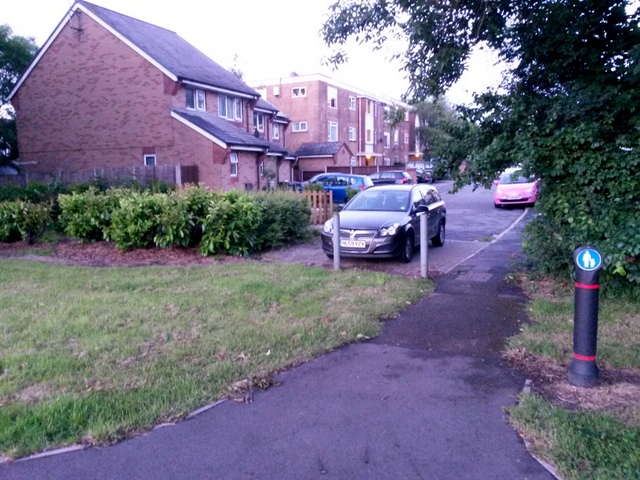
Image: © Chris Downer Taken: 28 Jun 2016
A very short public footpath - just 13 metres in length - linking the main Ringwood Road with the adjacent dead end of Anchor Close. The sign on the reverse of the bollard is for a shared foot/cycle path, referring to the pavement of Ringwood Road, where we are standing. The sign on this side denotes that cyclists should dismount on the path ahead. See Image for the view towards us from ahead.
Images are licensed for reuse under creativecommons.org/licenses/by-sa/2.0
Image Location
Latitude
50.768868
Longitude
-1.919545