West Howe: emerging from Tedder Walk on footpath U25
Introduction
The photograph on this page of West Howe: emerging from Tedder Walk on footpath U25 by Chris Downer as part of the Geograph project.
The Geograph project started in 2005 with the aim of publishing, organising and preserving representative images for every square kilometre of Great Britain, Ireland and the Isle of Man.

There are currently over 7.5m images from over 14,400 individuals and you can help contribute to the project by visiting https://www.geograph.org.uk
West Howe: emerging from Tedder Walk on footpath U25
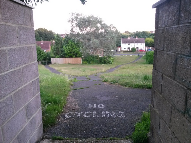
Image: © Chris Downer Taken: 28 Jun 2016
Tedder Walk emerges from between the gardens of two houses in Tedder Road, onto an open hillside above Moorside Road. The route of footpath U25 is the left-hand one, although the right-hand path is perhaps the more obvious route. See Image for the view along the alleyway behind us, and Image for the uphill view towards us - each with links to further photos on the route.
Images are licensed for reuse under creativecommons.org/licenses/by-sa/2.0
Image Location
Latitude
50.757168
Longitude
-1.905813