Pavor Farmhouse
Introduction
The photograph on this page of Pavor Farmhouse by Derek Harper as part of the Geograph project.
The Geograph project started in 2005 with the aim of publishing, organising and preserving representative images for every square kilometre of Great Britain, Ireland and the Isle of Man.

There are currently over 7.5m images from over 14,400 individuals and you can help contribute to the project by visiting https://www.geograph.org.uk
Pavor Farmhouse
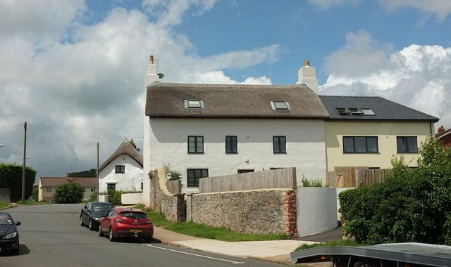
Image: © Derek Harper Taken: 24 Jun 2016
A view of Image after completion of its rebuild. See also Image, Image and the description at https://www.historicengland.org.uk/listing/the-list/list-entry/1208752 . Beyond are a pair of thatched cottages that are also listed https://www.historicengland.org.uk/listing/the-list/list-entry/1206771 https://www.historicengland.org.uk/listing/the-list/list-entry/1208760
Images are licensed for reuse under creativecommons.org/licenses/by-sa/2.0
Image Location
Latitude
50.488631
Longitude
-3.527889