
The South wall and Churchyard of All Saints church, Berners Roding, Essex
Introduction
The photograph on this page of The South wall and Churchyard of All Saints church, Berners Roding, Essex by Derek Voller as part of the Geograph project.
The Geograph project started in 2005 with the aim of publishing, organising and preserving representative images for every square kilometre of Great Britain, Ireland and the Isle of Man.

There are currently over 7.5m images from over 14,400 individuals and you can help contribute to the project by visiting https://www.geograph.org.uk
The South wall and Churchyard of All Saints church, Berners Roding, Essex
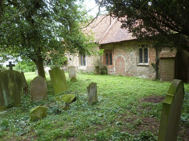
Image: © Derek Voller Taken: 27 Jun 2016
Berners Roding (or Roothing in some historical references) is one of nine Anglo Saxon settlements near the River Roding from which they all take their name. All Saints fell into disuse probably because of its isolated location and was deconsecrated in 1985. It is now privately owned and the churchyard under the care of Epping Forest Countrycare. For more information and some excellent interior pictures see http://www.28dayslater.co.uk/all-saints-chruch-berners-roding-essex.t61284
Images are licensed for reuse under creativecommons.org/licenses/by-sa/2.0
Image Location

Latitude
51.765943
Longitude
0.320148