Bridge 70m 195ch OWW, Lower Road
Introduction
The photograph on this page of Bridge 70m 195ch OWW, Lower Road by Roger Templeman as part of the Geograph project.
The Geograph project started in 2005 with the aim of publishing, organising and preserving representative images for every square kilometre of Great Britain, Ireland and the Isle of Man.

There are currently over 7.5m images from over 14,400 individuals and you can help contribute to the project by visiting https://www.geograph.org.uk
Bridge 70m 195ch OWW, Lower Road
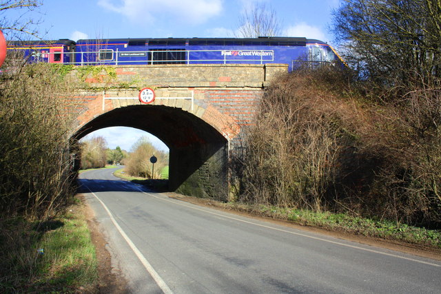
Image: © Roger Templeman Taken: 15 Feb 2016
There is an OS benchmark Image on the near end of the right hand side of the bridge arch. A HST led by Class 43 power car number 43160 'Sir Moir Lockhead OBE heads towards Paddington, 70 miles away.
Images are licensed for reuse under creativecommons.org/licenses/by-sa/2.0
Image Location
Latitude
51.822565
Longitude
-1.368091