Parish boundary marker, Botolph Alley, City of London
Introduction
The photograph on this page of Parish boundary marker, Botolph Alley, City of London by Christopher Hilton as part of the Geograph project.
The Geograph project started in 2005 with the aim of publishing, organising and preserving representative images for every square kilometre of Great Britain, Ireland and the Isle of Man.

There are currently over 7.5m images from over 14,400 individuals and you can help contribute to the project by visiting https://www.geograph.org.uk
Parish boundary marker, Botolph Alley, City of London
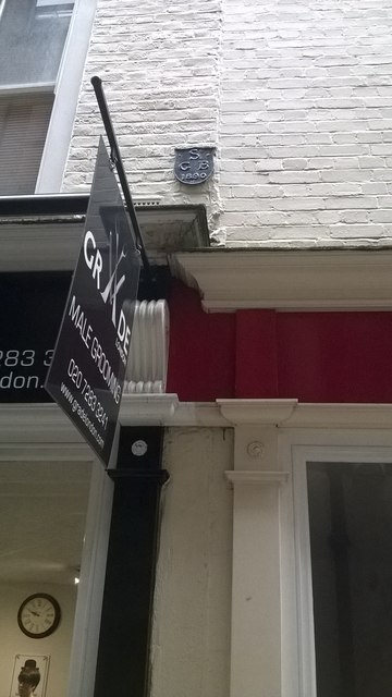
Image: © Christopher Hilton Taken: 13 Jun 2016
The plaque marks the parish of St George Botolph Lane, whose church (now vanished) lay to the left of this picture; to the right is the church of St Mary at Hill, whose parish presumably begins at this point.
Images are licensed for reuse under creativecommons.org/licenses/by-sa/2.0
Image Location


Leaflet Map data © OpenStreetMap
Latitude
51.510206
Longitude
-0.084434