The River Carron at Glensburgh
Introduction
The photograph on this page of The River Carron at Glensburgh by Mat Fascione as part of the Geograph project.
The Geograph project started in 2005 with the aim of publishing, organising and preserving representative images for every square kilometre of Great Britain, Ireland and the Isle of Man.

There are currently over 7.5m images from over 14,400 individuals and you can help contribute to the project by visiting https://www.geograph.org.uk
The River Carron at Glensburgh
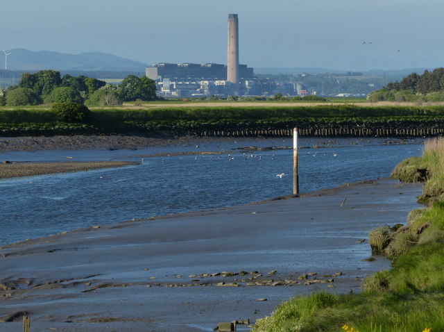
Image: © Mat Fascione Taken: 31 May 2016
Just over three miles away is the Longannet power station, situated on the north bank of the Firth of Forth near Kincardine. At the time of its completion in 1970 it was the largest power station in Europe. It had a generating capacity of 2,400 megawatts, the chimney is 183 m (600 ft) in height. Longannet power station closed on 24 March 2016 after failing to win a contract from the National Grid.
Images are licensed for reuse under creativecommons.org/licenses/by-sa/2.0
Image Location
Latitude
56.021036
Longitude
-3.747228