Malmesbury Park: footpath D07 to nowhere
Introduction
The photograph on this page of Malmesbury Park: footpath D07 to nowhere by Chris Downer as part of the Geograph project.
The Geograph project started in 2005 with the aim of publishing, organising and preserving representative images for every square kilometre of Great Britain, Ireland and the Isle of Man.

There are currently over 7.5m images from over 14,400 individuals and you can help contribute to the project by visiting https://www.geograph.org.uk
Malmesbury Park: footpath D07 to nowhere
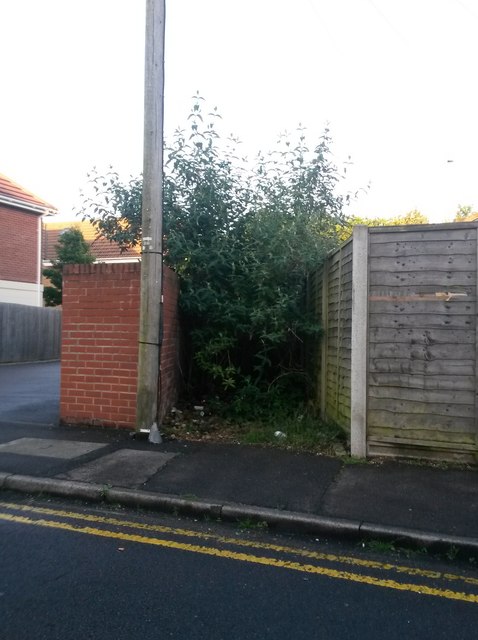
Image: © Chris Downer Taken: 23 Jun 2016
A rather stumpy public right of way proceeds 14m from Henville Road, whereupon it just stops. It did have a purpose before the roads here were realigned and severed to make way for the main A338 in the 1970s: Henville Road was previously a Y-shaped road, and this path cut the corner off within the centre junction of the 'Y'. Today, it is overgrown for about 13 of its 14-metre length, and as such is barely navigable even if there was some purpose for doing so. Needless to say, I didn't attempt to walk along it just now. It also appears to have become something of a litter repository.
Images are licensed for reuse under creativecommons.org/licenses/by-sa/2.0
Image Location
Latitude
50.731399
Longitude
-1.856698