Course of an old lade
Introduction
The photograph on this page of Course of an old lade by Lairich Rig as part of the Geograph project.
The Geograph project started in 2005 with the aim of publishing, organising and preserving representative images for every square kilometre of Great Britain, Ireland and the Isle of Man.

There are currently over 7.5m images from over 14,400 individuals and you can help contribute to the project by visiting https://www.geograph.org.uk
Course of an old lade
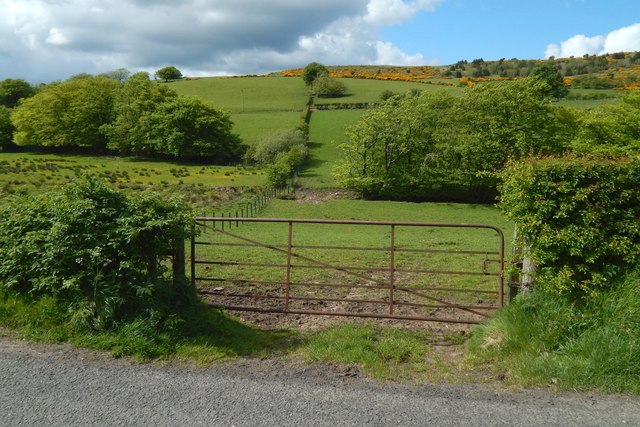
Image: © Lairich Rig Taken: 23 May 2016
The view is from Fereneze Road. The fence leading directly away from the left-hand side of the field gate is marked as a boundary on the 1:25000 map. Note the presence of lines of trees, parallel to the road, on either side of that fence. The lines are staggered: the trees to the right of the fence are nearer than those to the left. Those trees stand alongside a watercourse that is marked on the 1:25000 map. It is an old lade, and, as the map shows, it makes an abrupt change of direction to follow a short section of the fence before resuming its north-easterly course. As is pointed out at Image, the lade leads to an old reservoir at Image, which once served Gateside Cotton Mill. The mill itself is now gone, replaced by housing.
Images are licensed for reuse under creativecommons.org/licenses/by-sa/2.0
Image Location
Latitude
55.79229
Longitude
-4.422582