
Why all the skips?
Introduction
The photograph on this page of Why all the skips? by Roger W Haworth as part of the Geograph project.
The Geograph project started in 2005 with the aim of publishing, organising and preserving representative images for every square kilometre of Great Britain, Ireland and the Isle of Man.

There are currently over 7.5m images from over 14,400 individuals and you can help contribute to the project by visiting https://www.geograph.org.uk
Why all the skips?
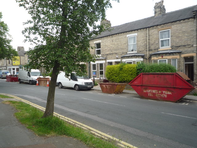
Image: © Roger W Haworth Taken: 8 Jun 2016
Nos. 36 - 24a Huntington Road seen from just south of the junction with Park Grove. Being an offcomer, I had to ask why every house in this row and the one to the left seemed to be having building work done. It was explained that at 2015 December every one of these houses had been flooded to about half a metre deep because the relevant authorities had taken the agonizing decision to raise the Foss Barrier and let the River Ouse flood back up into the Foss (behind these houses). Now every house is having to replace flooring and furniture.
Images are licensed for reuse under creativecommons.org/licenses/by-sa/2.0
Image Location

Latitude
53.966796
Longitude
-1.072716