Breached weir in Killoch Glen
Introduction
The photograph on this page of Breached weir in Killoch Glen by Lairich Rig as part of the Geograph project.
The Geograph project started in 2005 with the aim of publishing, organising and preserving representative images for every square kilometre of Great Britain, Ireland and the Isle of Man.

There are currently over 7.5m images from over 14,400 individuals and you can help contribute to the project by visiting https://www.geograph.org.uk
Breached weir in Killoch Glen
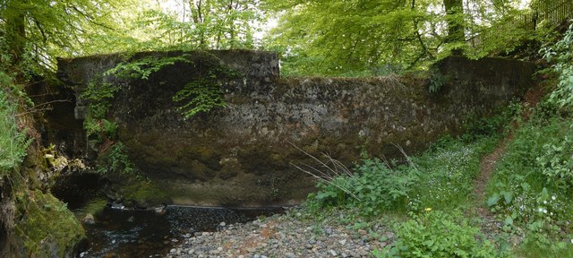
Image: © Lairich Rig Taken: 23 May 2016
Taking the map at face value, this picture was taken when standing in the middle of the water just upstream of the weir. The old weir itself is breached, as shown here, and the water level above it was, after a long period of dry weather, very low: the picture was taken from an expanse of pebbles (a former mill dam); the Killoch Water was no more than a gentle burn flowing around its western margin. See also Image, a view in the opposite direction from roughly the same spot. According to http://www.wosas.net/wosas_site.php?id=7559 (at WoSAS), the mill dam served "a small bleachfield at Low Auchentiber"; Low Auchentiber itself was at about Image The weir and mill dam on the Killoch Water had not yet been formed when the first-edition OS map was surveyed in 1858; those features make their first appearance on the second-edition map (a revision based on surveying work carried out in 1895). For views of the breach from the other side (and from higher up), see Image and Image
Images are licensed for reuse under creativecommons.org/licenses/by-sa/2.0
Image Location
Latitude
55.790567
Longitude
-4.427899