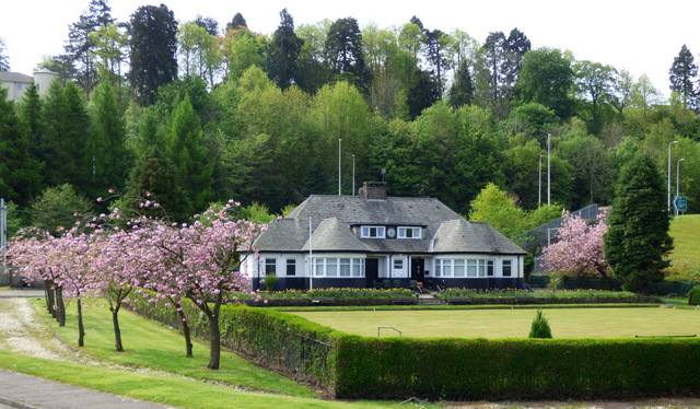
Parklea Bowling Club
Introduction
The photograph on this page of Parklea Bowling Club by Thomas Nugent as part of the Geograph project.
The Geograph project started in 2005 with the aim of publishing, organising and preserving representative images for every square kilometre of Great Britain, Ireland and the Isle of Man.
There are currently over 7.5m images from over 14,400 individuals and you can help contribute to the project by visiting https://www.geograph.org.uk

Image: © Thomas Nugent Taken: 11 May 2016
Parklea Pavilion, home to Parklea Bowling Club, was the main building in King George V Park. Some Woodhall residents were evacuated here during the war following bomb damage to their houses during the 1941 blitz which resulted in thirty deaths in nearby Woodhall Terrace. The tennis courts, putting green and swingpark are long gone, under the re-aligned A8 road, but the bowling club and the adjacent football pitches still thrive.

