Old bench mark on an old gatepost
Introduction
The photograph on this page of Old bench mark on an old gatepost by John S Turner as part of the Geograph project.
The Geograph project started in 2005 with the aim of publishing, organising and preserving representative images for every square kilometre of Great Britain, Ireland and the Isle of Man.

There are currently over 7.5m images from over 14,400 individuals and you can help contribute to the project by visiting https://www.geograph.org.uk
Old bench mark on an old gatepost
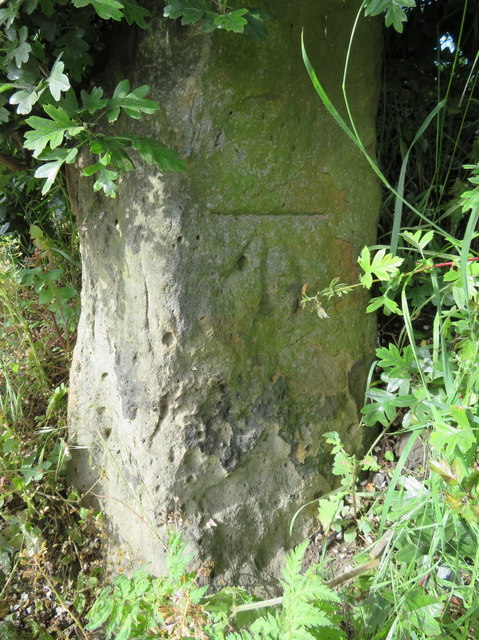
Image: © John S Turner Taken: 18 Jun 2016
This Ordnance Survey bench mark is on the remains of an old gatepost on the corner of Burniston Road and North Cliff Avenue. A mark is recorded at this location on the 1853-4 OS map levelled at 108.6ft and facing south. In 1893 it was levelled at 108.4ft and facing south, then in 1912 it was still levelled at 108.4ft but facing west. In 1914-19 it was again levelled at 108.4ft and still facing west, then in 1928 levelled at 108.3ft but facing south again. It then disappears from the 1938 and 1958 maps and re-appears in 1965 still levelled at 108.3ft and still facing south as it is today. Is it the original mark, was the stone moved, or is the way it was recorded all that changed? See also Image
Images are licensed for reuse under creativecommons.org/licenses/by-sa/2.0
Image Location
Latitude
54.29775
Longitude
-0.418071