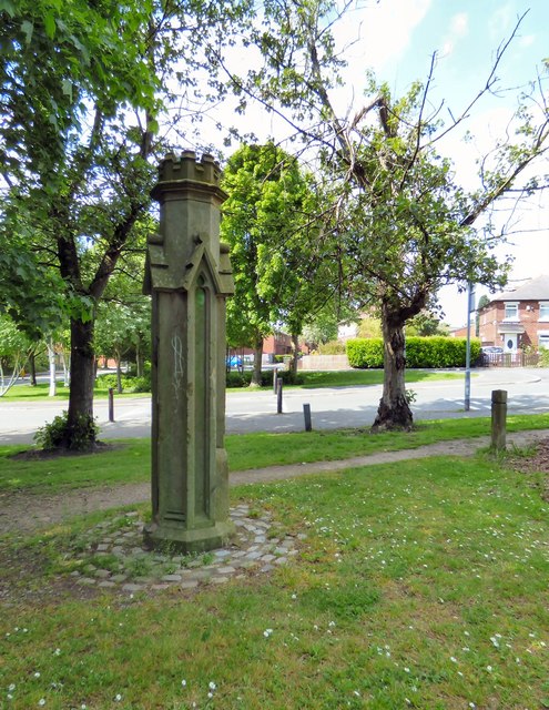
What is this?
Introduction
The photograph on this page of What is this? by Gerald England as part of the Geograph project.
The Geograph project started in 2005 with the aim of publishing, organising and preserving representative images for every square kilometre of Great Britain, Ireland and the Isle of Man.
There are currently over 7.5m images from over 14,400 individuals and you can help contribute to the project by visiting https://www.geograph.org.uk

Image: © Gerald England Taken: 29 May 2016
This object is located near the junction of Lower Bennett Street and Arnside Drive. See 2012 photograph from opposite direction Image I'd always surmised it was originally a gatepost but someone recently suggested it might have been a chimney which was used as a ventilation shaft for the local mine workings. Others have said it could be a guide-post. Local enquiries now appear to indicate that it was just a decorative looking pillar that council workmen had found lying around and thought that it would be a nice thing to stick there for people to admire. It seems to have appeared sometime in the 1980s.

