Barrhead ROC Bunker: GZI Mount
Introduction
The photograph on this page of Barrhead ROC Bunker: GZI Mount by Lairich Rig as part of the Geograph project.
The Geograph project started in 2005 with the aim of publishing, organising and preserving representative images for every square kilometre of Great Britain, Ireland and the Isle of Man.

There are currently over 7.5m images from over 14,400 individuals and you can help contribute to the project by visiting https://www.geograph.org.uk
Barrhead ROC Bunker: GZI Mount
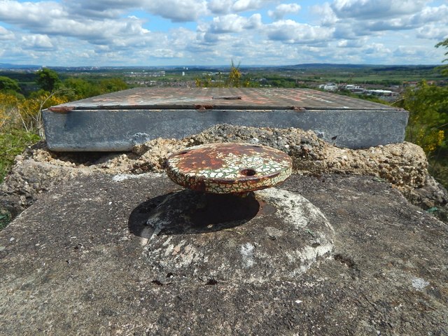
Image: © Lairich Rig Taken: 23 May 2016
For context, and for the main description, see Image At the back, in the present photograph, is the access hatch. In front of it is the GZI Mount, the support for the Ground Zero Indicator. The instrument itself, no longer present, was in the form of a drum with pinholes, and with photosensitive paper inside. It worked on similar lines to a sunshine recorder, but its purpose was to record the direction and elevation of nuclear blasts.
Images are licensed for reuse under creativecommons.org/licenses/by-sa/2.0
Image Location
Latitude
55.803494
Longitude
-4.405885