Historic hut
Introduction
The photograph on this page of Historic hut by John Baker as part of the Geograph project.
The Geograph project started in 2005 with the aim of publishing, organising and preserving representative images for every square kilometre of Great Britain, Ireland and the Isle of Man.

There are currently over 7.5m images from over 14,400 individuals and you can help contribute to the project by visiting https://www.geograph.org.uk
Historic hut
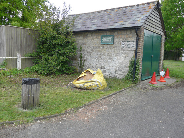
Image: © John Baker Taken: 15 May 2016
The wording on the green board, affixed to the wall of the hut, reads: this hut was built in 1833 and used as the village soup kitchen, providing nourishment to the needy. Renovated in 1992 and dedicated to the memory of Councillor Reg Harrison.
Images are licensed for reuse under creativecommons.org/licenses/by-sa/2.0
Image Location
Latitude
51.233408
Longitude
0.530913