Creation of access to building site
Introduction
The photograph on this page of Creation of access to building site by John Baker as part of the Geograph project.
The Geograph project started in 2005 with the aim of publishing, organising and preserving representative images for every square kilometre of Great Britain, Ireland and the Isle of Man.

There are currently over 7.5m images from over 14,400 individuals and you can help contribute to the project by visiting https://www.geograph.org.uk
Creation of access to building site
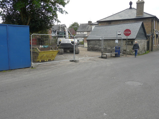
Image: © John Baker Taken: 15 May 2016
Planning permission has been granted by Maidstone Borough Council under application number 13/0028 for the “erection of one pair of semi-detached dwellings with access as shown on drawing nos. 011/020/4-001 RevA, 011/020/4-003 RevA, 011/020/4-004 RevA, and 011/020/4-005 RevA received on 7th January 2013, tree report received on 6th June 2013, heritage statement received on 24th June 2013, and 011/020/4-002 RevB received on 20th September 2013”. The development is to be on land, adjacent to The Albion Inn (the building on the right), which is hidden in this view by the blue hoarding.
Images are licensed for reuse under creativecommons.org/licenses/by-sa/2.0
Image Location
Latitude
51.232943
Longitude
0.531604